PRECISION BEYOND THE SURFACE
Producing precise and qualified marine geophysical and geotechnical data for your project.
about us
We are a Brazilian marine geoscience company, operating in Brazil and abroad. We combine scientific rigor, consistent data, and tailored solutions for each project.
ㅤㅤㅤㅤWe are a Brazilian marine geoscience company, operating in Brazil and abroad. We combine scientific rigor, consistent data, and tailored solutions for each project.
The 4SAS team consists of two Brazilian professionals focused on marine geophysics and geotechnics, with over 15 years of experience and more than 80 successful projects. Beyond delivering data, we deliver confidence. Our work spans from planning to qualified interpretation — always focused on risk mitigation and the best solution for each challenge.
OUR DATA ACQUISITION TECHNIQUES
Whether to enable a new port terminal, install submarine cables, support oil and gas operations, monitor dredging, or map the seafloor for wind farms and conservation areas — our approach starts with choosing the right technique, or combination of techniques. Below are the main methodologies we use.
high-resolution impulse seismic
One of the 4SAS differentials. We have knowledge, experience, and access to the most advanced and proven mono and multichannel seismic solutions for shallow and deep waters.
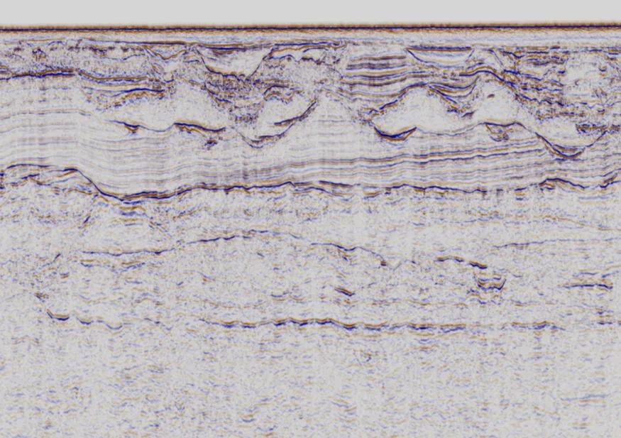
Impulse Seismic
Resonant Seismic
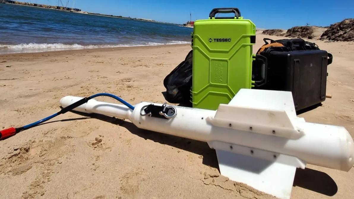
With Sub-Bottom Profilers (SBPs) from top manufacturers and careful operation, we master resonant seismics to precisely map sedimentary layers and deliver effective results.
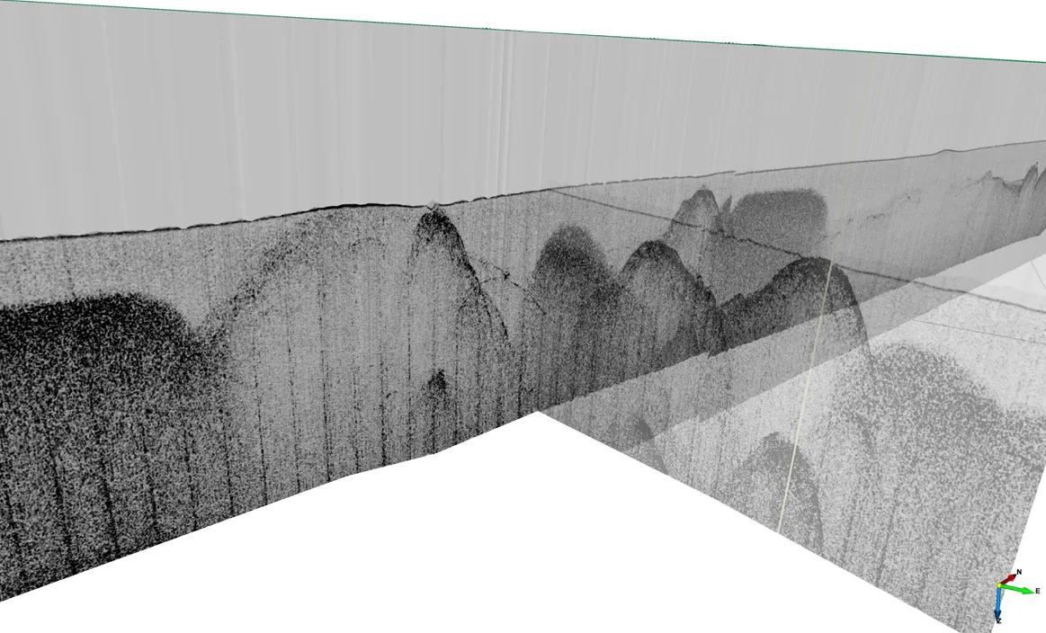
Resonant Seismic
Sonographic Imaging
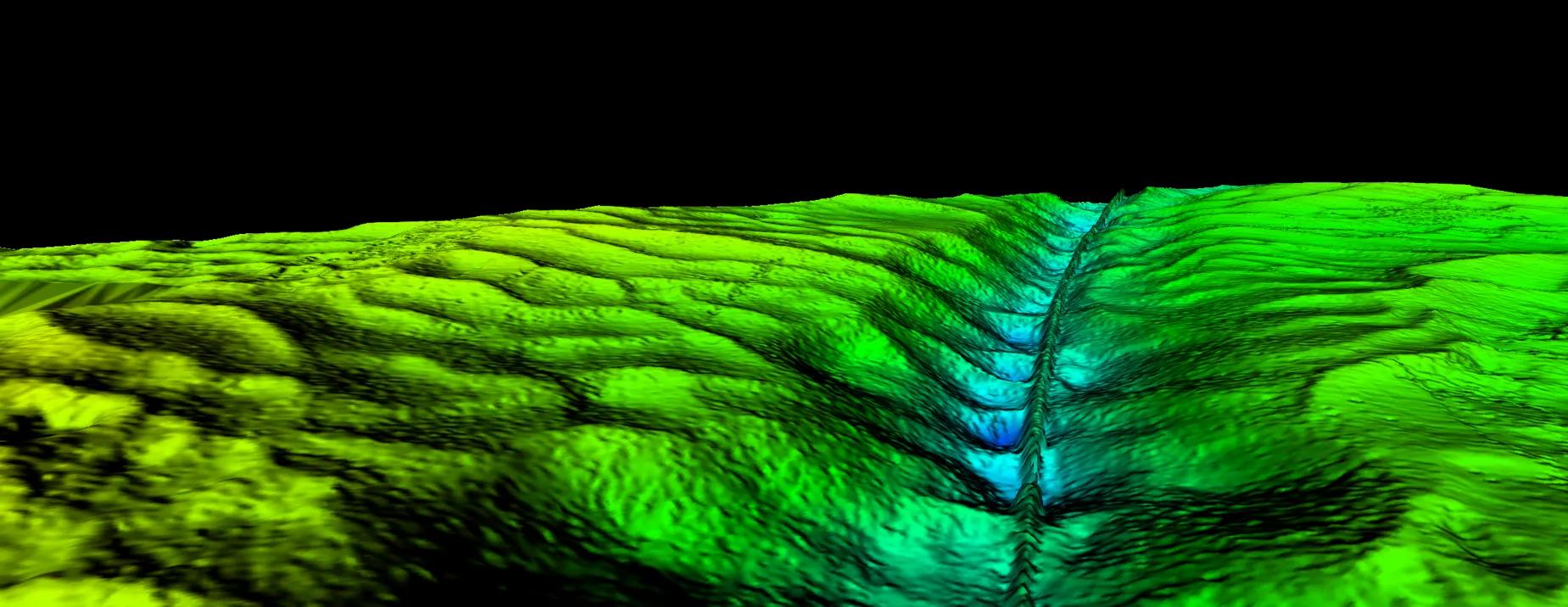
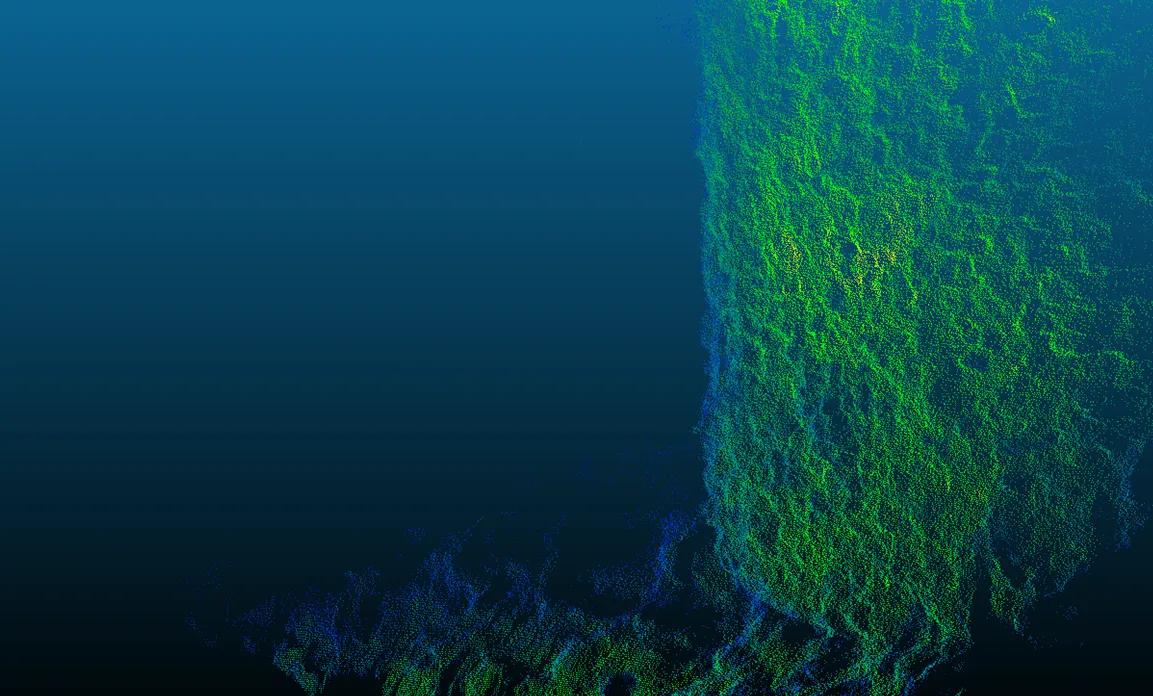
Side Scan Sonar and MBES for detailed seafloor mapping and detection of objects, structures, and anomalies.
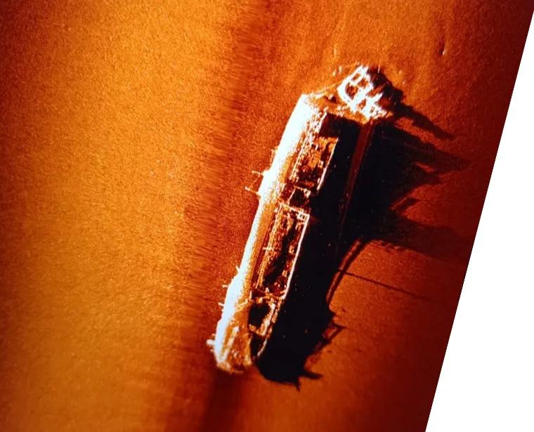
Sonographic Imaging
Magnetometry and Gradiometry
Detection and characterization of metallic targets on and below the seafloor — pipelines, cables, anchors, munitions, and buried structures.
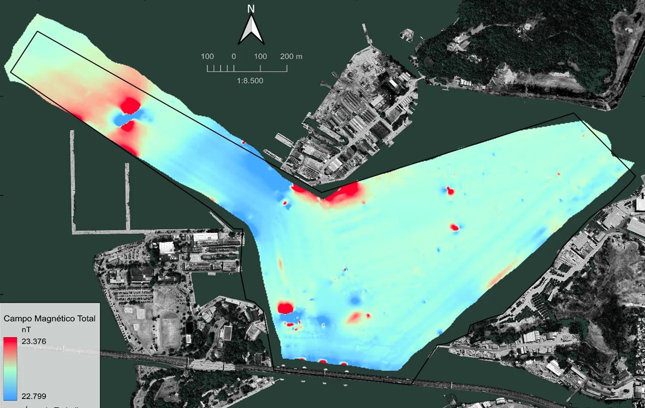
Magnetometry & Gradiometry
Hydrography
Precision bathymetric surveys with MBES and SBES, following IHO standards, for engineering projects, dredging, and nautical charting.
Hydrography
Underwater Positioning
USBL and LBL systems for tracking and positioning ROVs, divers, and subsea equipment.
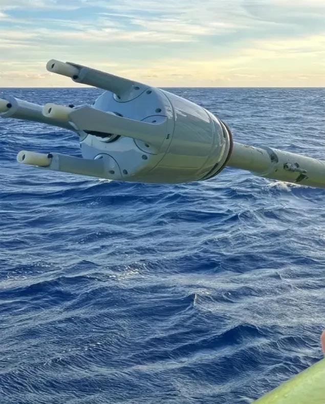
Underwater Positioning
Marine Geotecnics
With the objectives of validating geophysical data and obtaining geotechnical parameters, we carried out the acquisition and analysis of geotechnical data in shallow and deep waters using methods such as vibrocorer, piston corer, and CPT (Cone Penetration Test).
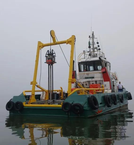
Marine Geotecnics
Operational Oceanography
We use a solution based approach and non-negotiable operational safety to monitor and measure waves, currents, tides, and other metocean parameters.
Operational Oceanography
solutions
RISK MITIGATION IN MARITIME PROJECTS
An essentially multidisciplinary task, integrating specific techniques for desk studies, fieldwork (land and sea), and cartography. With dozens of projects executed in Brazil and abroad, our experience makes 4SAS a reliable partner for project success.
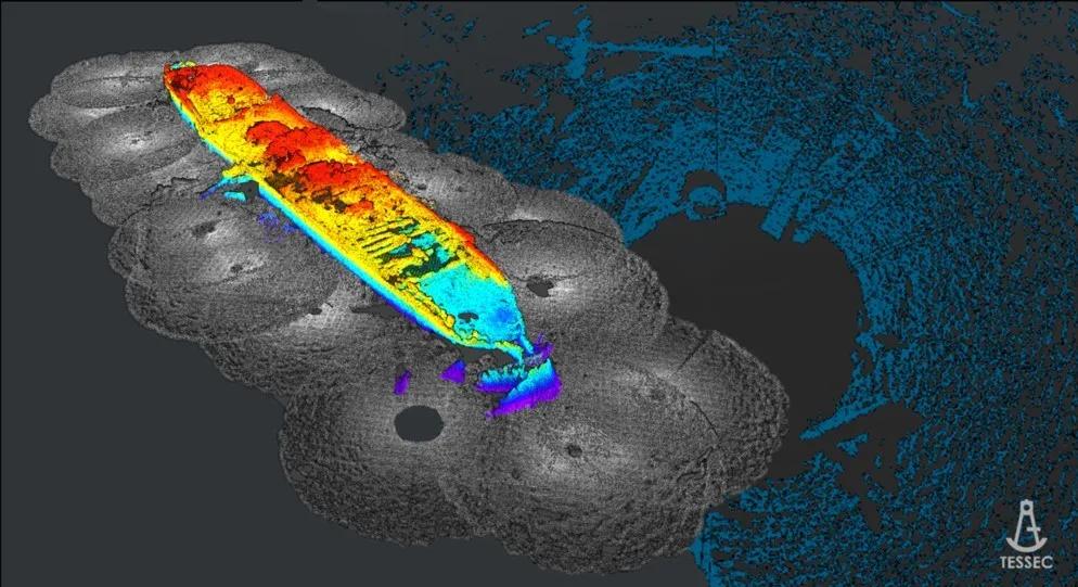
OBJECT SEARCH AND OBSTRUCTION MAPPING
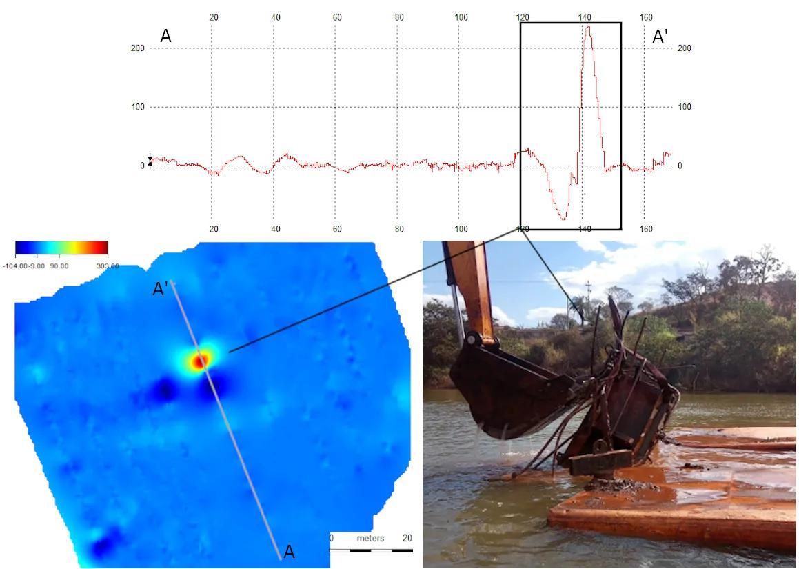
Location and characterization of objects on the seafloor — shipwrecks, anchors, munitions, pipelines, and abandoned structures. Risk area mapping prior to offshore construction.
OPERATIONAL OCEANOGRAPHY
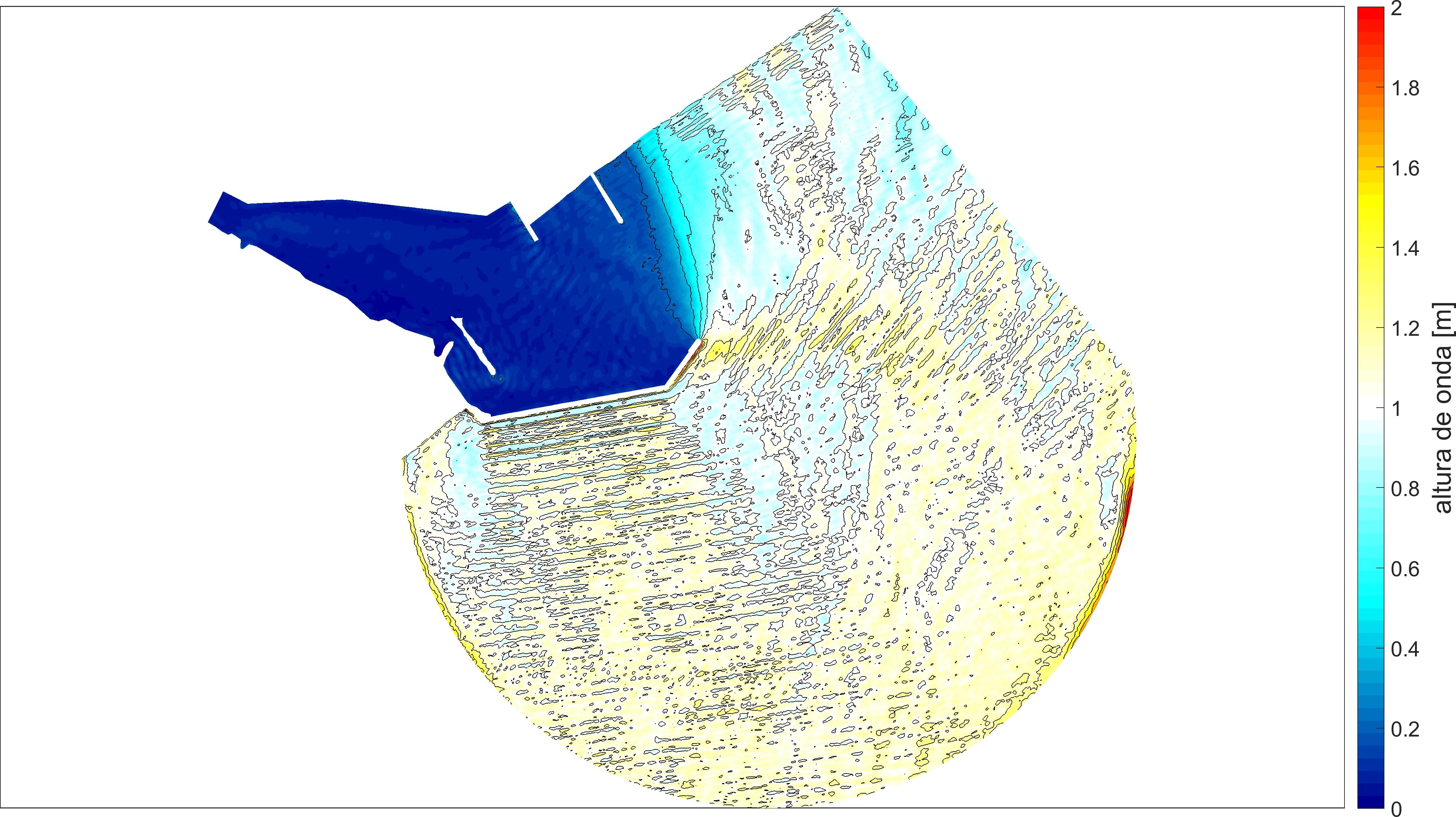
Foundation for port and offshore operability and impact assessments. We collect wave, current, and environmental data using ADCPs, wave buoys, CTDs, and backscatter sensors — in Brazil and abroad — integrating this information into studies and numerical simulations.
MONITORING
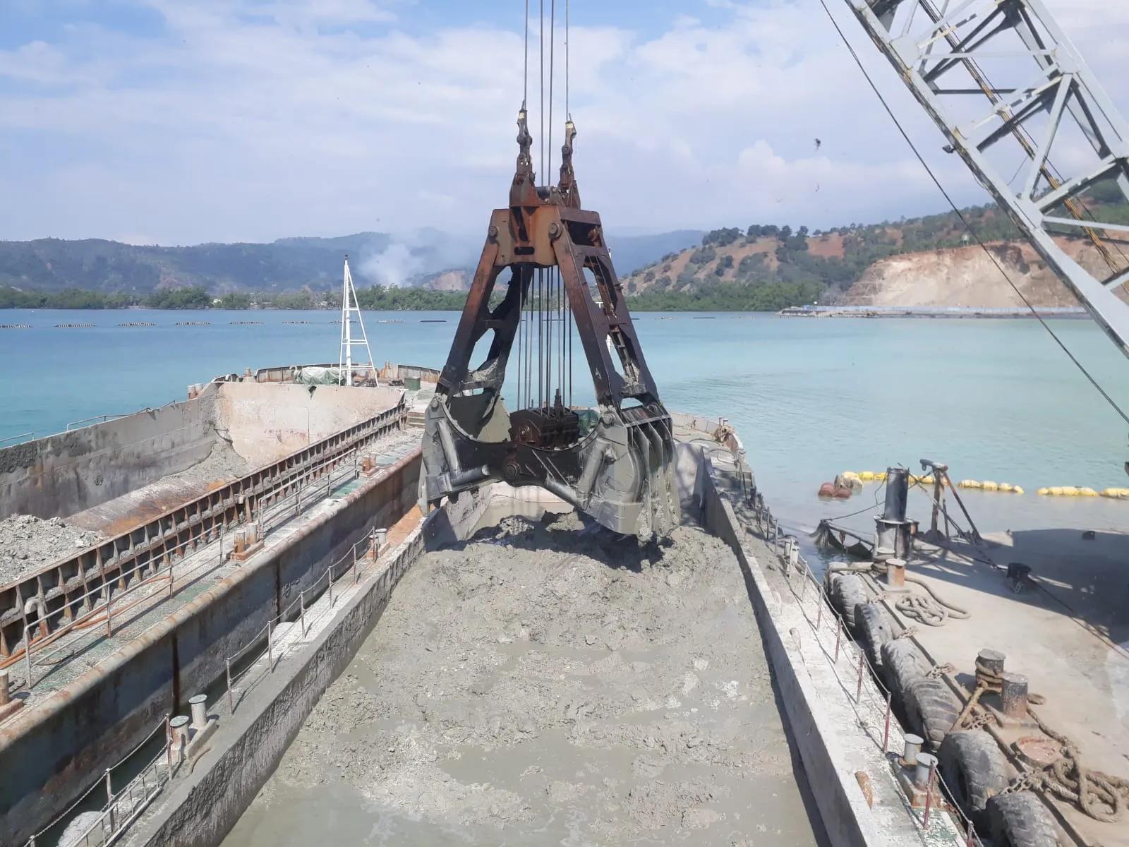
Continuous monitoring solutions with bathymetric and oceanographic data collection for long-duration projects, such as material volume in dredging works and environmental licensing projects.
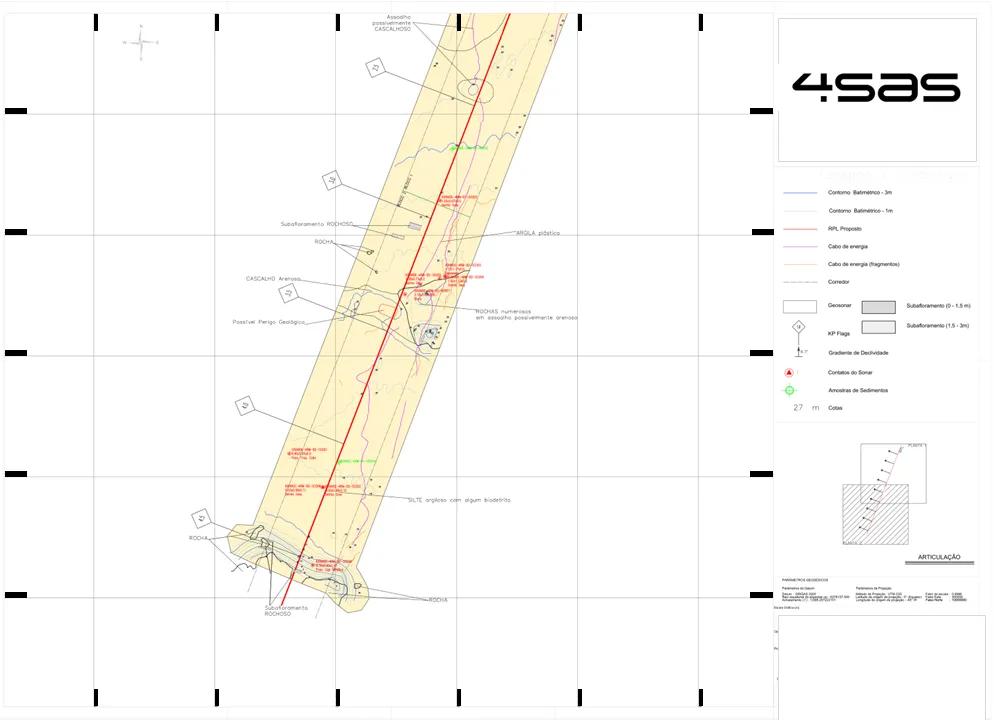
SEARCH AND CHARACTERIZATION OF SUBMARINE DEPOSITS
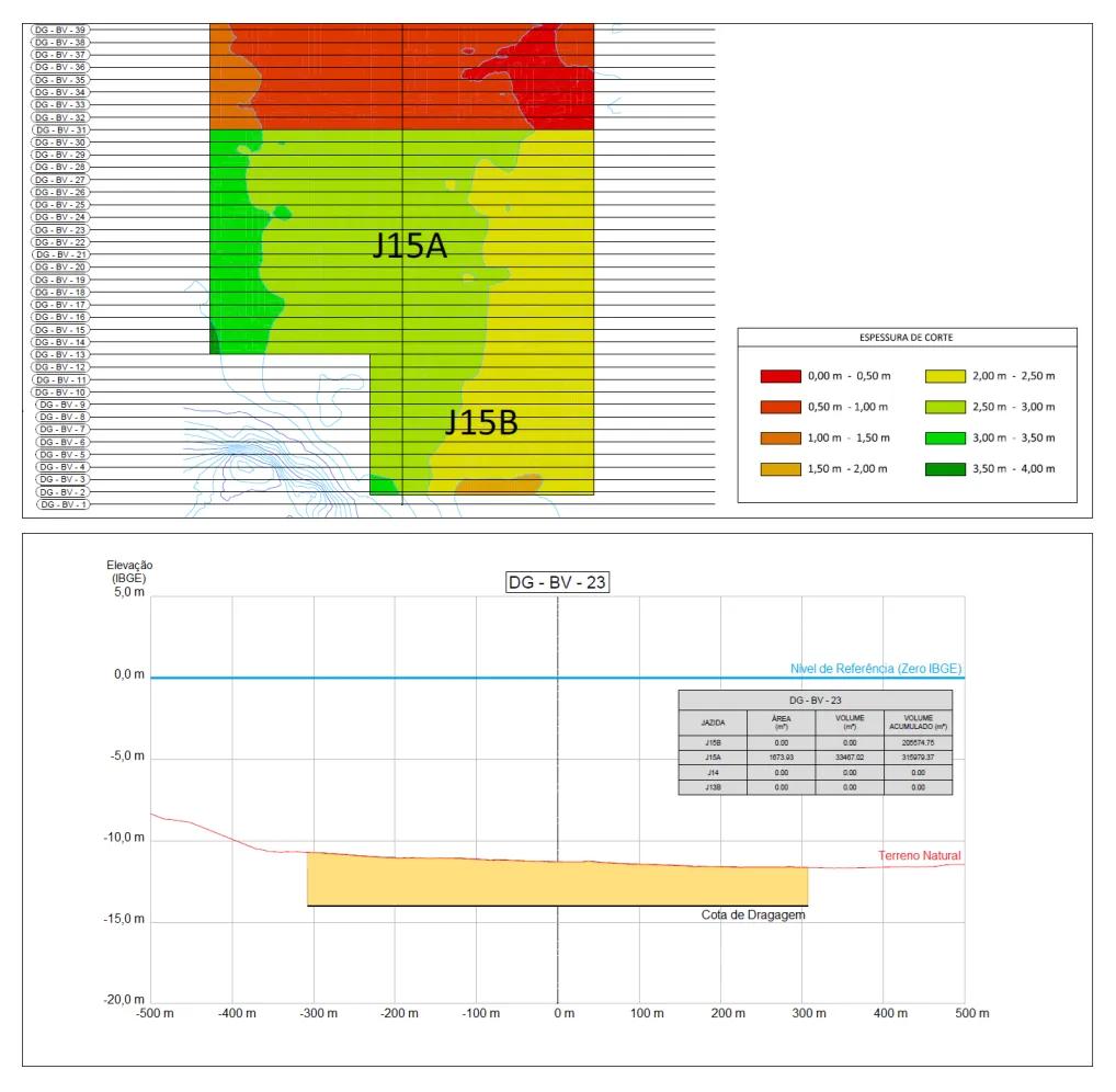
From prospection to volumetric calculation, we apply proven methodology to characterize marine mineral resource deposits — for beach nourishment or mineral exploitation.
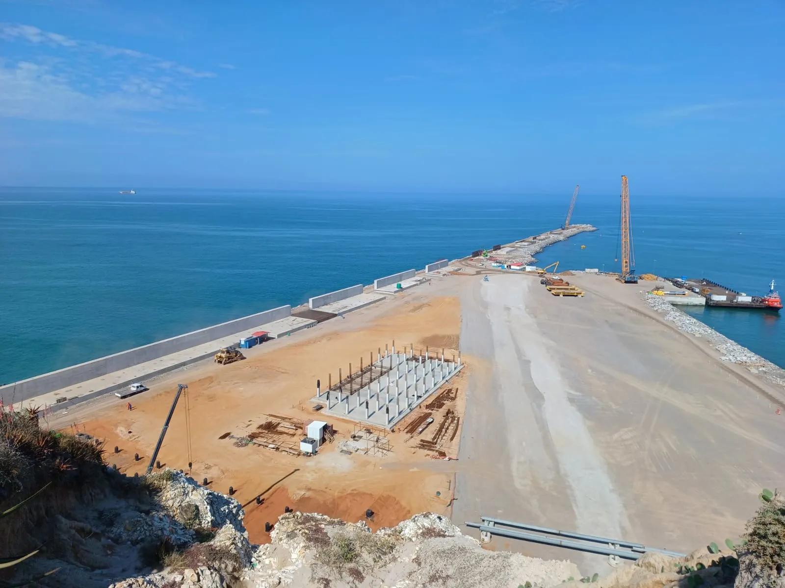
COASTAL AND PORT ENGINEERING
Projects from conception to execution: offshore port layout, waterways, dredging, protection and stabilization structures (breakwaters, jetties, groins), and nautical signaling.
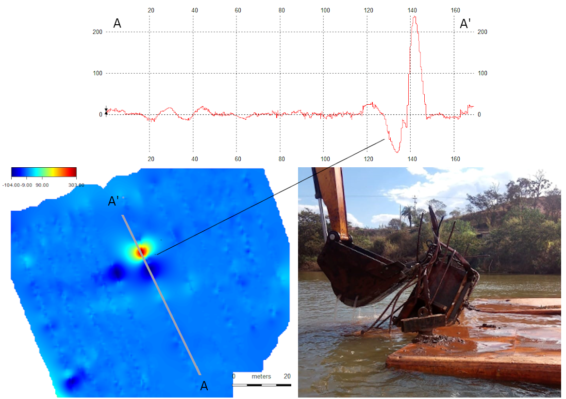
RISK MITIGATION IN DAMS AND BRIDGES
Evaluation of integrity and risk in hydraulic and retaining structures, combining bathymetry, seismics, magnetometry, and sediment sampling.
QUALITY ASSURANCE
Precision control and assurance
Continuous field monitoring to validate information, increase reliability, and optimize operational costs.
Planning
We thoroughly evaluate project objectives to define the best approaches. At this stage, we generate an Execution Plan with critical information, such as propagated error calculations and adherence to specifications.
When data acquisition is involved, all equipment is bench-tested and tank-tested at our facility.
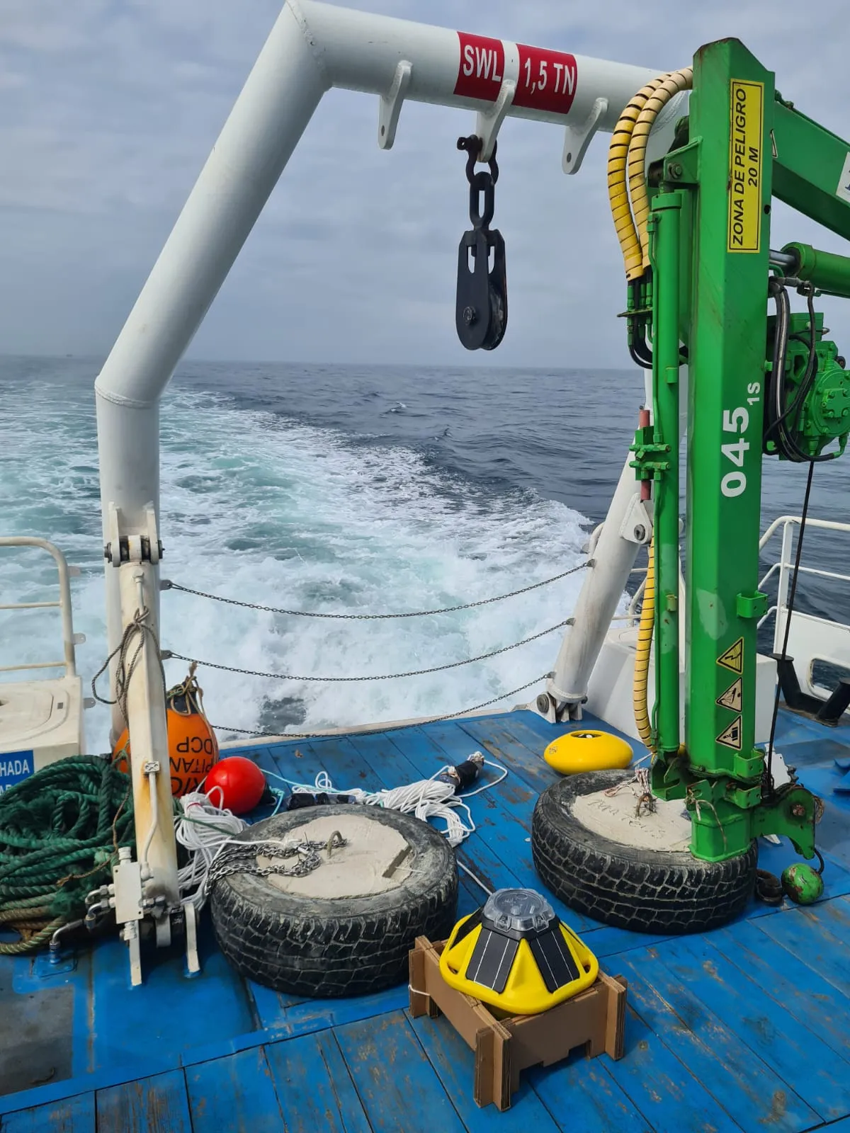
Mobilization
A critical phase in data acquisition projects. We apply rigorous procedures ensuring sensor performance and operational safety: onboard bench testing, trigger management (avoiding interference between equipment), crew alignment, and load tests — all focused on data quality and operational safety.
Calibration and Validation
Real-condition water tests challenge data quality and sensor non-interference.
We go beyond standard specifications: we evaluate vessel noise, magnetic detectability, seismic and sonographic positioning, among others.
We generate complete reports comparing theoretical and real errors.
Execution
"Boring is Good" — our operation must be free of surprises. We monitor data in real time for quality verification and need for re-acquisition.
We control coverage and infills in office or on-site, present partial results, and maintain secure backup on the 4SAS server and on the vessel.
PRODUCTS
The materialization of all effort: consistent products delivered on time. Our work is only complete when the client knows how to use each piece of information — and can rely on them to make decisions.
faq
frequently asked questions
Frequently asked questions about our services, steps, and deliverables.
IS IT POSSIBLE TO USE ALL SENSORS SIMULTANEOUSLY IN AN AQUATIC SURVEY?
Yes, possible and recommended. It is precisely this integration that enhances results. Conducting the survey with multiple sensors in a single pass (single-pass) ensures greater data consistency, improves interpretation capability, and brings operational and financial efficiency to the project.
BUT DOES USING SENSORS SIMULTANEOUSLY NOT CAUSE NOISE IN THE DATA?
It can, if not handled carefully. That is why our mobilization and testing procedures eliminate sensor interference (cross talk) — ensuring clean and reliable data, regardless of the vessel.
HOW LONG DOES DATA PROCESSING AND INTERPRETATION TAKE?
The timeline depends on factors such as project complexity, environmental conditions, and the expected deliverable type. Part of our differentiator is the quality control procedures during acquisition, which speed up subsequent steps. These variables are always discussed in advance and transparently — ensuring the schedule is not only met, but planned realistically from the start.
WHY SO MANY SEISMIC OPTIONS? CHIRP, PINGER, BOOMER, SPARKER... DOES USING MULTIPLE EQUIPMENT GUARANTEE THE BEST RESULT?
Not necessarily. Each high-frequency seismic technique delivers a specific type of subsurface information. Chirps, pingers, boomers, and sparkers are sources — generally associated with single-channel data — and the choice of the most suitable one depends on the project objective. In some cases, only multichannel streamers or 3D seismics are capable of answering the right question. Combining equipment without criteria can increase costs and complexity without delivering the expected gain. That is why our approach is always to indicate, with transparency and technical commitment, the most efficient solution for each challenge.
WHY DOES YOUR VIBROCORE REQUIRE A LARGER VESSEL?
To ensure the contracted core size is always achieved. The Geo-Corer 3000+6000 is robust and efficient in virtually any bottom type, capable of acquiring cores of 3, 6, and up to 12 m at depths of up to approximately 600 m. The trade-off is that it requires a vessel with adequate lifting capacity — generally above 5 tons.
Talk to 4SAS and move forward with precision
Get in touch to clarify doubts, request information, or discuss scope, deadlines, and services. Our team responds with clear and objective guidance.
